
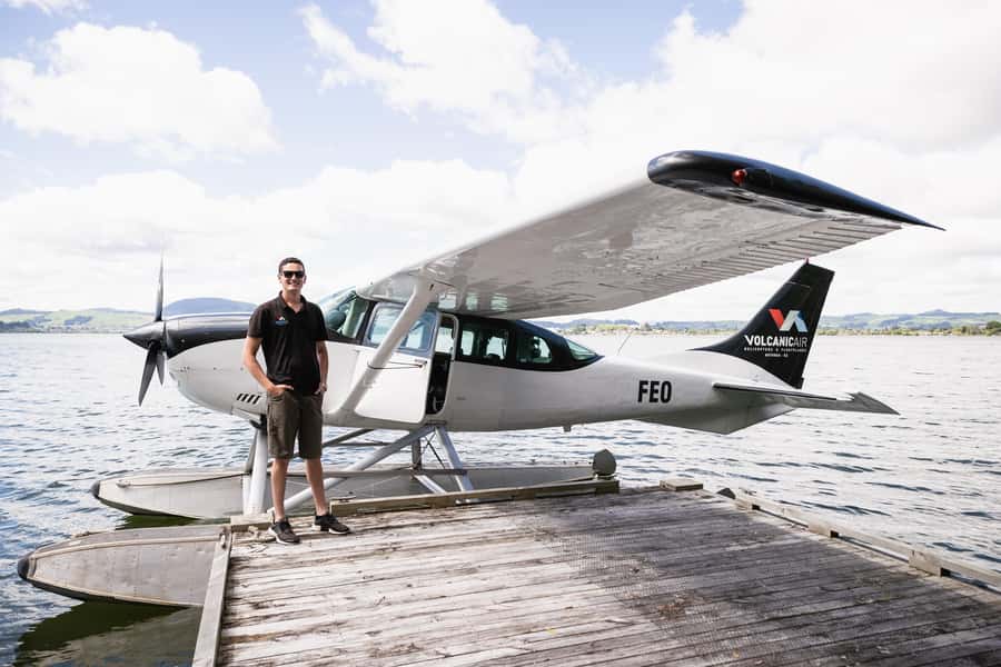
REVIEW · SCENIC FLIGHTS
Rotorua: Scenic Flight over Mt Tarawera & Waimangu Valley
Seaplane flights change how you see Rotorua. This 40-minute ride from Lake Rotorua turns the geothermal region into a flying map, with close passes over Mt Tarawera and the crater lakes. You get a live English guide on board, plus an audio guide, so it is not just sightseeing from a window.
I love two things most. First, the actual floatplane take off and water landing feels like a real event, not a photo stop. Second, you fly over the 8 km crater rift line from the 1886 eruption and get the story of what it changed in this area, including the lost Pink and White Terraces.
One thing to plan around: this experience is weather dependent. If conditions are unsafe or visibility is poor, the flight may not happen, and the exact route or circuit can vary.
In This Review
- Quick hits before you fly
- From the Rotorua lakefront to the first burst of air
- Mokoia Island, the hidden lakes district, and the Rotorua lake view
- Mount Tarawera over the crater rift line at 3,680 feet
- Waimangu Thermal Valley: Inferno Crater and Frying Pan Lake from above
- Returning over Whakarewarewa and Pohutu Geyser, then back to the lake
- Price and the real value of 40 minutes at $236
- Weather, safety, and who should think twice
- Who this Rotorua floatplane should suit best
- Should you book this floatplane flight?
- FAQ
- How long is the experience, and how much time is spent flying?
- Where does the flight depart from?
- What areas do you fly over?
- Do you get a guide during the flight?
- Is the flight always the same route?
- What should I bring?
- Are bags allowed?
- What is the group size?
- Who is the tour not suitable for?
- Are there weight-related rules?
Quick hits before you fly
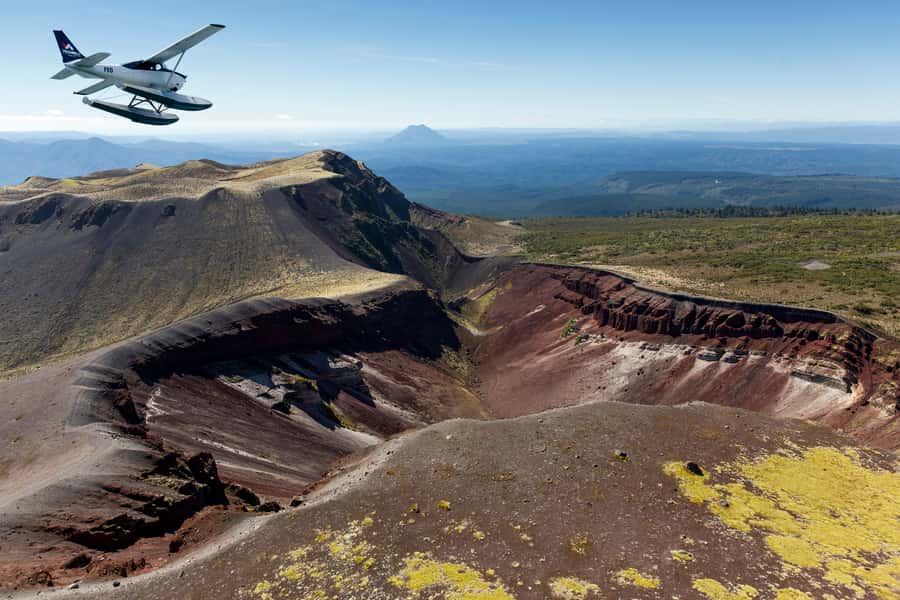
- Floatplane lake takeoff and landing right from the Rotorua lakefront
- Window seats for all passengers in a small group of 10 or fewer
- Mount Tarawera at 3,680 feet with crater views and the 1886 eruption story
- Waimangu Thermal Valley air views including Inferno Crater and Frying Pan Lake
- Return flight over Whakarewarewa Thermal Valley and Pohutu Geyser before landing back on Lake Rotorua
From the Rotorua lakefront to the first burst of air
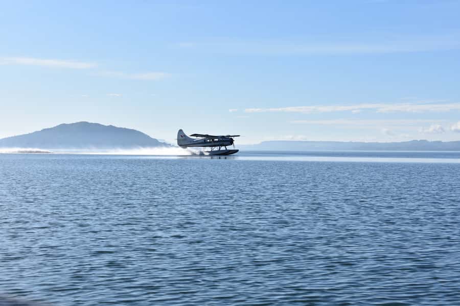
You start at Lakefront Drive and check in at an office building marked with large roof signs. The timing is tight but relaxed, and there is a safety briefing first, about 20 minutes. The whole experience is listed as 40 minutes, with around 30 minutes in the air, so you are never waiting forever once you’re geared up.
Bring a camera and warm clothing. Rotorua weather can shift fast, and on open-view moments you will feel it more than you expect. Also note the practical rule: bags are not allowed, so travel light. If you are the kind of person who carries everything “just in case,” this is your sign to simplify.
What makes this opening segment special is how quickly you move from lakeside to sky. You climb around Mokoia Island, then head over a ridge toward the hidden lakes area. Even early on, you begin seeing Rotorua’s geothermal system as a set of lakes and valleys, not separate attractions. That framing matters later when you look at Tarawera and Waimangu.
The one drawback of a flight like this is obvious but worth saying: you need to be comfortable in a small aircraft environment. You will be seated close, and if heights bother you, the seaplane feel is still a real factor.
More scenic flights from Rotorua:
- Crater Lakes Scenic Flight with Natural Hot Pool Bathing by Floatplane
★ 5.0 · 6 reviews - Milford Sound Small Group Tour from Queenstown with Scenic Flight
★ 5.0 · 324 reviews - Kaikōura Whale Watching Scenic Flight (40 Minutes)
★ 5.0 · 221 reviews
Mokoia Island, the hidden lakes district, and the Rotorua lake view
Once you are airborne, you get that “now I get it” moment. From above, Rotorua’s 13 lakes look like they are scattered across a bowl, connected by valleys and ridgelines. From the ground, it is easy to think of each lake as its own stop. From the air, they read like parts of the same system.
The route early on also includes native NZ bush and the ridge line toward the hidden lakes district. That mix is useful because it gives you contrast: clean greens below and the mineral color shifts ahead near the volcano. If you are photographing, this is the stage where you can test settings. Bright daylight helps, but the best results often come when you shoot with patience during steadier portions of the flight.
A small but important detail: the group is limited to 10 participants. That keeps things orderly during the briefing and helps the crew manage window viewing. In one flight experience, passengers highlighted that window seats were available for all, which is exactly what you want on a scenic flight. You do not want to spend your entire ride craning or settling for the middle seat view.
If the weather is choppy, you might still get airborne, but the pilot could adjust the plan. So think of this segment as an opening gallery. Even if conditions later change the full circuit, you will usually still come away with recognizable Rotorua geography.
Mount Tarawera over the crater rift line at 3,680 feet
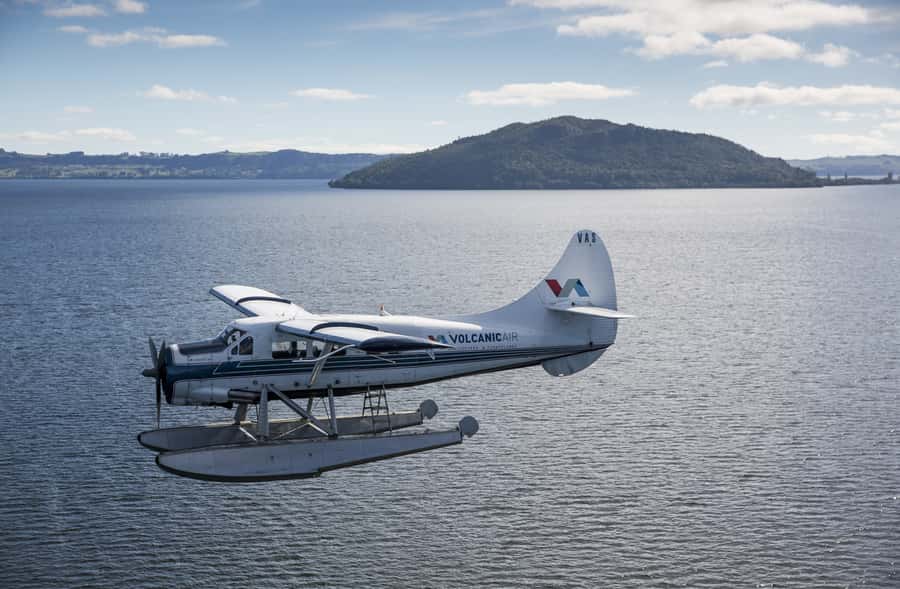
The main event is the pass over Mount Tarawera, listed at 3,680 feet elevation dominating the area. You fly up and over the volcanic peaks, and the visuals are the point: crater color, steep slopes, and the way the lakes sit around the volcano like a ring.
You will also fly over the 8 km crater rift line left by the 1886 eruption. This is not vague trivia. The pilot explains how that eruption devastated the region, including what were once famous Pink and White Terraces, which had been called the eighth wonder of the world. From the air, that story lands differently. You can actually see how the terrain around Rotorua had the space to be reshaped on a large scale.
Why this aerial angle is worth it: geothermal areas are hard to picture in 3D from the ground. From above, you can connect the dots between crater geometry and the surrounding lake system. The flight gives you a quick spatial sense you cannot easily get from a single lookout.
During this portion, keep your camera ready but also watch with your eyes for a minute at a time. Crater rift lines and color bands are the kind of feature that look better when you take them in slowly. The pilot’s path is designed for viewing, but it still moves quickly.
The possible downside is also tied to this volcano segment. If visibility is limited, the flight may be shortened or not go ahead at all, because this experience is selling the views. If you are someone who cannot stand the idea of any uncertainty, pick your Rotorua day carefully and avoid scheduling something critical immediately afterward.
Waimangu Thermal Valley: Inferno Crater and Frying Pan Lake from above
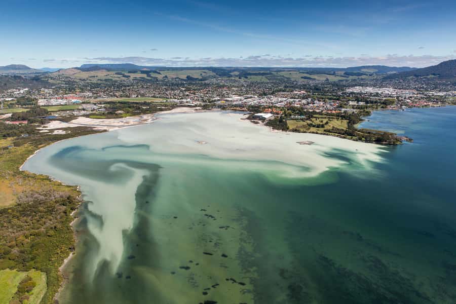
After Tarawera, you head toward the Waimangu Volcanic Valley, another big reason people choose this specific flight. From the air, Waimangu reads like a geothermal blueprint. You see how thermal features occupy space in the valley and how the terrain channels water and heat.
You get aerial views of the Inferno Crater and Frying Pan Lake. Those names sound dramatic, and the air view helps explain why. From ground level, it can feel like you are looking at individual attractions. From the sky, you see the valley’s shape and how features relate to each other in the same flow of landforms.
The onboard guide also shares context about Rotorua and its geothermal parks. That matters because Waimangu is not just scenery. It is a living area tied to volcanic processes, and having the basic story while you look prevents the experience from turning into pure photo taking.
If you like learning while you travel, this part is especially satisfying. You get the kind of explanation that helps you translate what you are seeing. You walk away with the feeling that you could spot clues later if you visit any geothermal areas on the ground.
One small practical note: this is not a long lesson. It is a flight. So if you want extra reading afterward, plan to use the aerial views as your mental map when you look up details later.
A few more Rotorua trips worth comparing
- Rotorua Canopy Tours: 2.5Hour Native Forest Zipline Adventure
★ 5.0 · 4,563 reviews - Mitai Maori Village: Cultural Experience and Dinner Buffet
★ 4.7 · 3,575 reviews - Rotorua: Wai-O-Tapu Geothermal Park Entry Ticket
★ 4.6 · 2,601 reviews - Rotorua’s Ultimate Zipline: 6 ziplines, 400 m Tandem, Cliff Walk
★ 5.0 · 2,557 reviews
Returning over Whakarewarewa and Pohutu Geyser, then back to the lake
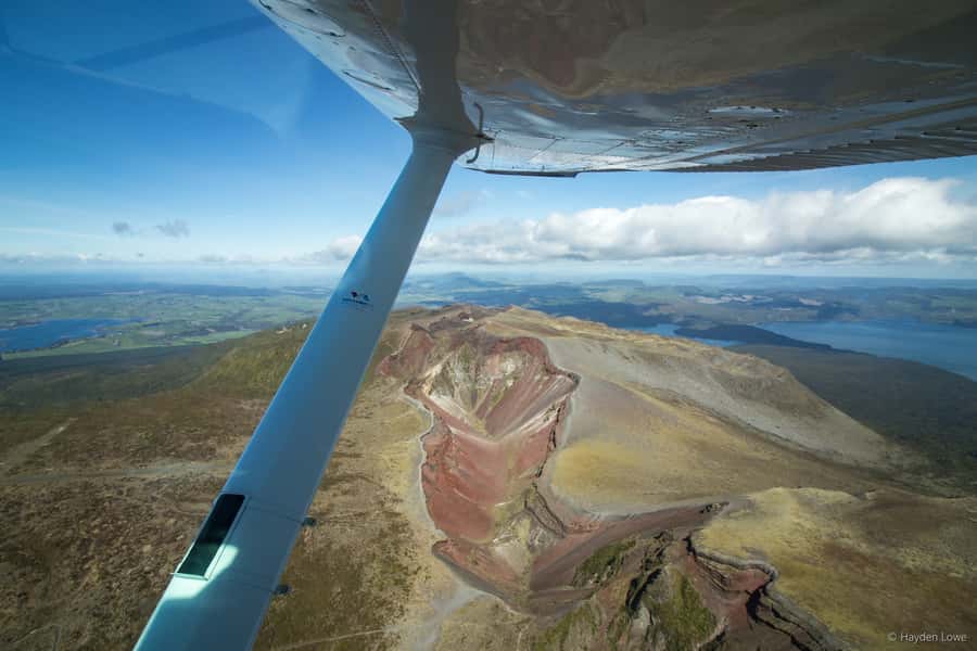
On the way back, the route includes more geothermal highlights. Your descent takes you past Whakarewarewa Thermal Valley and over Pohutu Geyser, then toward the city before landing back on Lake Rotorua.
This return pass is valuable for two reasons. First, it gives you a second set of visuals. After Tarawera and Waimangu, you can compare how different geothermal zones look from above. Second, you end with “Rotorua as a place,” not just geothermal points of interest.
The landing matters. A water touchdown changes your sense of time and motion compared with runway wheels. It also reinforces the unique “seaplane” factor that makes this tour different from a standard helicopter or fixed-wing sightseeing flight.
The final step includes a short on-foot moment, about three minutes. Think of it as the wrap up after you land, not another activity. You are done quickly, which is part of the appeal if your Rotorua schedule is packed.
If you are photographing, this is often when people realize they should have brought a second memory card or cleaned their lens. Clouds can soften color, but the overall shape and layout of Rotorua stays visible. Pohutu Geyser and the geothermal valleys can be harder to interpret from above, so this is when you shift from “get the perfect shot” to “understand the geography.”
Price and the real value of 40 minutes at $236
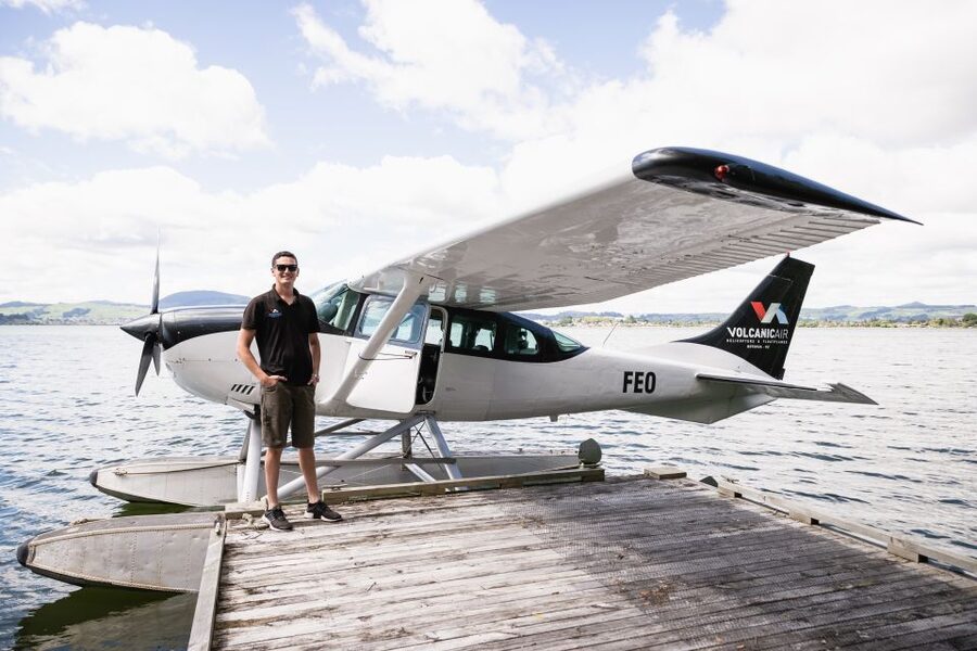
At $236 per person for a 40-minute experience, you are not paying for a long tour. You are paying for a fast aerial overview of multiple geothermal landmarks that are otherwise spread out.
The value comes from four things the flight includes:
- About 30 minutes in the air, which is enough time to see more than one major area
- Direct aerial passes over Mount Tarawera’s crater rift line and the Waimangu Thermal Valley features
- A live English guide plus an audio guide in English, so you get explanation along the way
- A small group with a cap of 10, which keeps the experience calm and window viewing practical
I also like that the experience is designed around viewing conditions. The operator will not run the flight if it is not safe or if views cannot be seen. That reduces the chance you pay and get blurry disappointment. And if the full circuit cannot happen due to weather, you may still get airborne portions, and there can be a small refund adjustment. That is the kind of fairness you want when nature calls the shots.
Still, here is the honest tradeoff. You cannot control weather, volcanic activity, or visibility. You also cannot stretch the flight into a deep visit of one geothermal site. If you want museums, long walking trails, and time for ground viewpoints, you will likely prefer pairing this with an on-land geothermal activity.
If your goal is to get a 3D understanding fast, this price starts to feel reasonable. It buys you perspective. And in Rotorua, perspective is half the battle.
Weather, safety, and who should think twice
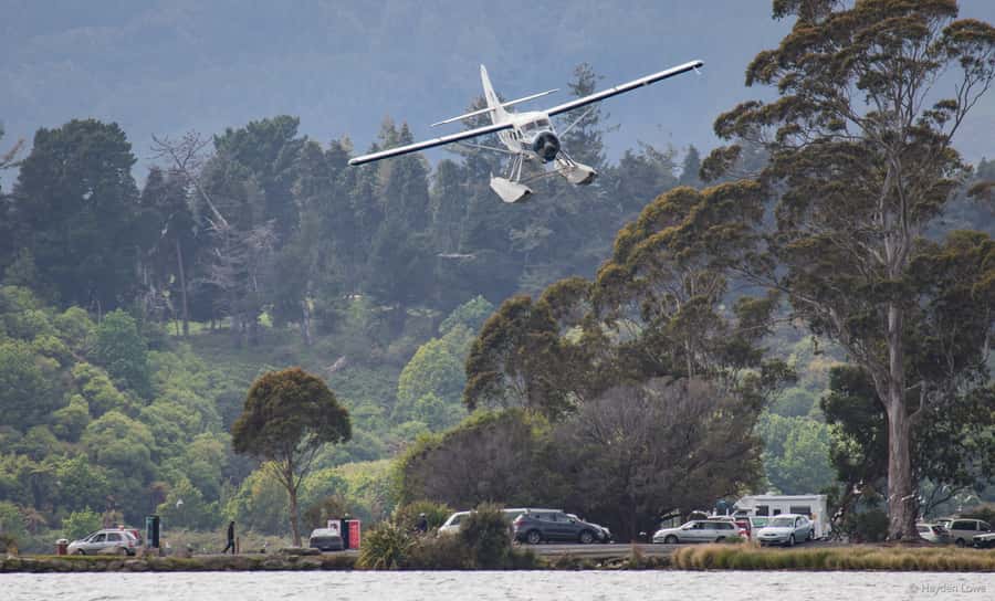
This flight is weather dependent. If it is not safe or the views cannot be seen, it will not go ahead. That is not a small footnote. It is central to how the flight operates. You may also see variation in tour duration, flight times, and inclusions depending on weather, volcanic activity, and passenger loadings.
Safety is handled with a briefing before takeoff, and the pilot controls the route. The data also notes that excursion landings are at your own risk and solely at the pilot’s discretion. In other words, this is not a pick-your-own-adventure stop you can plan around. You follow crew decisions.
There are also clear limits on who it suits. It is not suitable for wheelchair users, and it is not a fit for people afraid of heights. If you have altitude sickness concerns, it may not be the best idea either. The flight does not claim it is perfectly altitude-proof, so err on the side of caution.
One more practical rule: bags are not allowed. That affects what you can bring and how you store personal items. Pack light so your camera and warm layer are easy to manage.
If you are sensitive to cold, bring more than you think you need. Rotorua can feel mild until you’re in open-air moments near water and during flight.
Who this Rotorua floatplane should suit best
This is ideal if you want a quick, high-impact aerial overview of the Rotorua geothermal region. I think it fits especially well for:
- First-timers who want to connect Rotorua lakes, volcanic terrain, and geothermal valleys in one go
- Photographers who want to capture the crater rift geometry and lake layouts that you simply cannot see from the ground
- People who prefer short travel time inside a structured plan, rather than piecing together multiple long stops
It is also a good “connector” experience. After you fly over Tarawera and Waimangu, ground stops tend to make more sense. Even if you do not plan to do additional trails, you will still have a mental map that makes Rotorua easier to navigate.
On the other hand, if you strongly dislike heights, you should reconsider. Seaplanes feel exposed, even when the crew handles things calmly. And if weather uncertainty would wreck your schedule, it is smart to keep this flight flexible.
Should you book this floatplane flight?
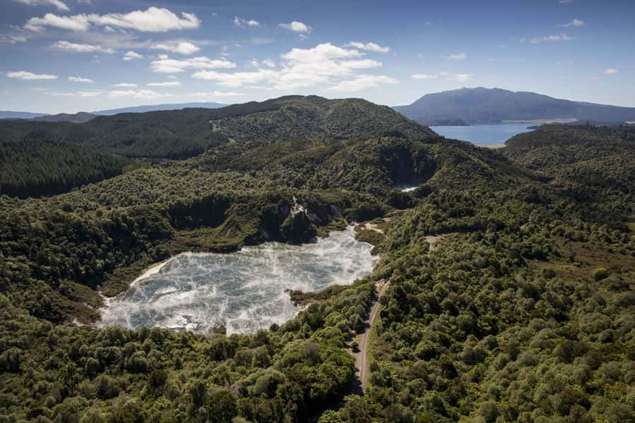
If you are coming to Rotorua and you want the volcano and geothermal areas explained in a way your brain can picture, I think you should book it. Mount Tarawera’s 1886 story, the Waimangu Thermal Valley air views, and the return over Whakarewarewa Thermal Valley and Pohutu Geyser add up to a lot of “wow” in a short time.
Book it when you have buffer time for weather and when you are comfortable with a small aircraft and open views. Skip it if heights or altitude sickness concerns are a deal breaker, or if you need fully predictable timing.
The best sign you are making the right call is simple: if you enjoy aerial perspectives and want geology and geothermal scenery in one compact experience, this delivers.
FAQ
How long is the experience, and how much time is spent flying?
The experience is listed as 40 minutes, with about 30 minutes of flying.
Where does the flight depart from?
You depart from the Rotorua lakefront, with the meeting point at Lakefront Drive. Check in at the office building with large signs on the roof.
What areas do you fly over?
You fly over Rotorua and its lakes, Mount Tarawera, the Waimangu Thermal Valley area including Inferno Crater and Frying Pan Lake, and on the return you pass Whakarewarewa Thermal Valley, Pohutu Geyser, and Rotorua city before landing back on Lake Rotorua.
Do you get a guide during the flight?
Yes. There is a live English guide, and an English audio guide is also included.
Is the flight always the same route?
No. The flight is weather dependent, and tour duration, flight times, and inclusions may vary due to weather conditions, volcanic activity, and passenger loadings.
What should I bring?
Bring a camera and warm clothing.
Are bags allowed?
Bags are not allowed.
What is the group size?
The group is small, limited to 10 participants.
Who is the tour not suitable for?
It is not suitable for wheelchair users, people afraid of heights, or people with altitude sickness.
Are there weight-related rules?
Yes. Individual weights are required at booking. If an individual exceeds 110 kgs, a surcharge may apply, and anyone exceeding 135 kgs may be required to pay two adult fares.
Just added near Rotorua
- Whakarewarewa: Self-Guided Geothermal Trails★ 4.5 · 41 reviews
- From Rotorua: Whirinaki Rainforest Guided Cultural Tour★ 5.0 · 6 reviews
- Rotorua: Waimangu Volcanic Valley Entry Ticket★ 4.8 · 129 reviews
- White Island & Mount Tarawera Floatplane Adventure★ 5.0 · 8 reviews
- Whirinaki Forest Footsteps: Māori Guided Tour, Picnic & Transfer★ 5.0 · 5 reviews
- Wonderworld Rotorua – New Zealand’s leading maze park★ 5.0 · 11 reviews
- Whaka Geothermal Trails Self-Guided Tour★ 3.5 · 44 reviews
- Rotorua Sledging White Water Sledging | Kaitiaki Adventures★ 5.0 · 90 reviews
Scenic Flights, compared.
Milford Sound Small Group Tour from Queenstown with Scenic Flight
Read our review →
Kaikōura Whale Watching Scenic Flight (40 Minutes)
Read our review →
Cape Reinga Half-Day Tour Including Scenic Flight
Read our review →
Scenic Flight Transfer to Queenstown from Milford Sound
Read our review →
Milford Sound and Big Five Glaciers Scenic Flight
Read our review →Browse the lists this tour appears in